
Utilities
AreaMap: Measure Land & Acres
AreaMap estimates land area and perimeter from tapped map points or a recorded GPS boundary.
Consider it for rough planning after reviewing the Pro requirement
Named measurements, material estimates and export formats connect a drawn shape to a reusable report.
Keep in mind: The developer explicitly says it is not a legal survey; imagery, GPS and entered boundaries limit precision.
Inside the app
Official product images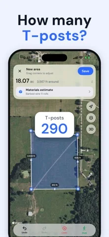
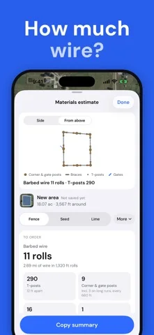
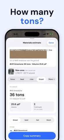
What you can do
- Map drawing and GPS boundary recording
- Area distance circle and marker tools
- Pro reports materials and geospatial exports
Good for
- People estimating a yard field or landscaping project
Consider alternatives for
- Users deciding legal boundaries sales or permits without a surveyor
Limitations & considerations
- Captured minimum: iOS 17.0.
- The developer explicitly says it is not a legal survey; imagery, GPS and entered boundaries limit precision.
Privacy & permissions
Stored property locations, photos and reports can identify a home or business; review location and sharing permissions.
Sources & review notes Updated Nov 11, 2026
Reviewed by iApp4Me Editorial Team. Recommendations use the linked documentation and attributed accounts; device observations are identified separately.
- US App Store developer description
Complete description, download price and compatibility metadata captured 2026-11-02.
No comments yet. Be the first to share your experience.