
Foggy: Bay Area Fog Tracker
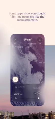
A San Francisco Bay Area fog map combining satellite imagery, playback and approximate community reports.
Consider for observing local fog patterns
Two-hour and twenty-four-hour loops provide context beyond a single satellite frame.
Keep in mind: The described five-minute updates and fog classification are service claims, not guaranteed visibility measurements. Coverage is centered on the Bay Area.
Inside the app
Official product images

What you can do
- View supported satellite maps
- Replay recent fog movement
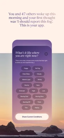
- Read or submit community reports
- Maintain the described personal report logbook
Good for
- Residents and visitors interested in local fog conditions.
Consider alternatives for
- People expecting a general global forecast or an authoritative aviation or road-safety assessment.
Limitations & considerations
- Captured minimum: iOS 18.0.
- The described five-minute updates and fog classification are service claims, not guaranteed visibility measurements. Coverage is centered on the Bay Area.
Privacy & permissions
The publisher describes a random installation identifier, approximate report locations and no ads or data sale. Anonymous to other users is not the same as no network processing.
Sources & review notes Updated Nov 11, 2026
Reviewed by iApp4Me Editorial Team. Recommendations use the linked documentation and attributed accounts; device observations are identified separately.
- US App Store developer description
Complete description, download price and compatibility metadata captured 2026-11-02.
No comments yet. Be the first to share your experience.