Business
Metes and Bounds Pro
Draw land tracts from entered deed measurements and calculate area and closure.
Useful for visualizing a legal description before professional review
Multiple units, endpoint coordinates and several tracts support historical or property sketches.
Keep in mind: Drawings depend on entered calls; this does not establish legal boundaries or replace a licensed survey, and auto-completion can conceal a missing call.
Inside the app
Official product images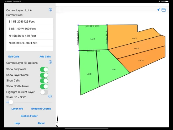
What you can do
- Metes-and-bounds plotting in varied units
- Area/perimeter/closing-error calculations
- Multiple tracts, endpoint coordinates and desktop file exchange
Good for
- People reviewing deed or historical map geometry
Consider alternatives for
- A certified boundary survey or legal determination
Limitations & considerations
- Captured minimum: iOS 15.6.
- Drawings depend on entered calls; this does not establish legal boundaries or replace a licensed survey, and auto-completion can conceal a missing call.
Privacy & permissions
Deeds and exported tract files can identify property owners and locations; choose storage and email recipients carefully.
Sources & review notes Updated Nov 12, 2026
Reviewed by iApp4Me Editorial Team. Recommendations use the linked documentation and attributed accounts; device observations are identified separately.
- US App Store developer description
Complete description, download price and compatibility metadata captured 2026-11-02.
No comments yet. Be the first to share your experience.