
Navigation
Theodolite HD
Theodolite HD combines an iPad camera view with orientation, map and location annotations.
Consider it for documenting an outdoor observation with contextual readings
Data-overlay photos and exported markers can keep a visual record connected to a place and project.
Keep in mind: Phone sensors are not a certified survey instrument; the HD edition is for iPad and does not establish legal boundaries or safety-critical navigation accuracy.
Inside the app
Official product images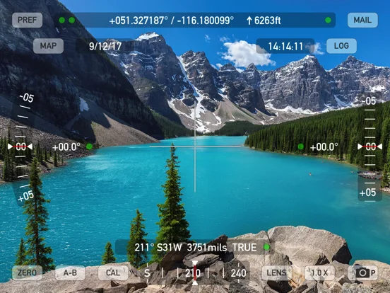
What you can do
- Compass inclination and location displays
- Geo-annotated photos movies and notes
- Map markers polygons and data exports
Good for
- Outdoor users documenting observations within known sensor limits
Consider alternatives for
- People requiring certified land surveys or guaranteed emergency navigation
Limitations & considerations
- Captured minimum: iOS 15.6.
- Phone sensors are not a certified survey instrument; the HD edition is for iPad and does not establish legal boundaries or safety-critical navigation accuracy.
Privacy & permissions
Photos and metadata can expose exact locations; optional team tracking and message sharing widen the audience.
Sources & review notes Updated Nov 11, 2026
Reviewed by iApp4Me Editorial Team. Recommendations use the linked documentation and attributed accounts; device observations are identified separately.
- US App Store developer description
Complete description, download price and compatibility metadata captured 2026-11-02.
No comments yet. Be the first to share your experience.